Environmental Scan
College of the Desert Environmental Scan presents data about the community that make
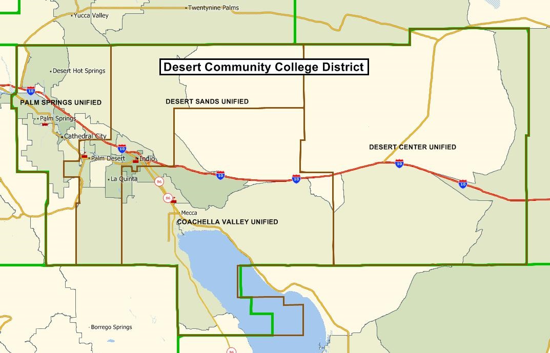
up the Desert Community College District. The map, below, shows that the district
encompasses four school districts in the Coachella Valley - Palm Springs Unified,
Desert Sands Unified, Coachella Valley Unified, and Desert Center Unified (going west
to east). The district serves the communities of Cathedral City, Coachella, Desert
Center, Desert Hot Springs, Indian Wells, Indio, La Quinta, Mecca, Mountain Center,
North Palm Springs, Palm Desert, Palm Springs, Rancho Mirage, Thermal, Thousand Palms,
and portions of Blythe, Mountain Center, Salton City and Whitewater.
The Environmental Scan covers three main areas: Population, Education, and Economic
Characteristics. Data reported in the scan comes primarily from the 2017 American Community Survey. Other data sources include the Inland Empire Economic Report, California Department
of Education, and COD MIS files. Please see the EnviroScan Source Appendix 2019 document for detailed information on where to find the data. Data is as current as is available.
Population
Education
- Education Level
- High School Graduates
- High School Graduates Completing All UC/CSU Requirements
- College Enrollment
- Capture Rate, COD, 2018-2019